Five houses, one site visit, eleven floor plans
client anonymousFive occupied rental houses scanned in one site visit with a handheld SLAM scanner and drafted into eleven dimensioned CAD floor plans with gross floor area for every level.
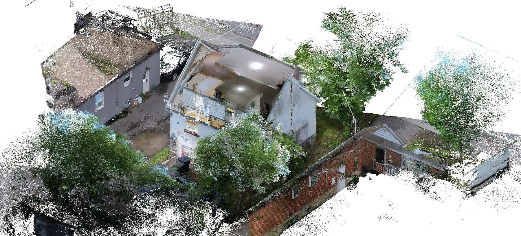
Our client needed measured floor plans for five occupied rental houses side by side in North York, with the gross floor area of every level. The plans had to be ready for planning conversations and permit application, so they needed real dimensions, not a sketch.
Measuring that by tape and laser distance meter means a day per house and a second visit for anything missed. We did all five in one mobilization. Each house took one continuous walk with OmniSLAM R8+ handheld scanner, between six and thirteen minutes. Everything after that happened at the desk.
Here is the workflow, using House C (three levels) as the worked example.
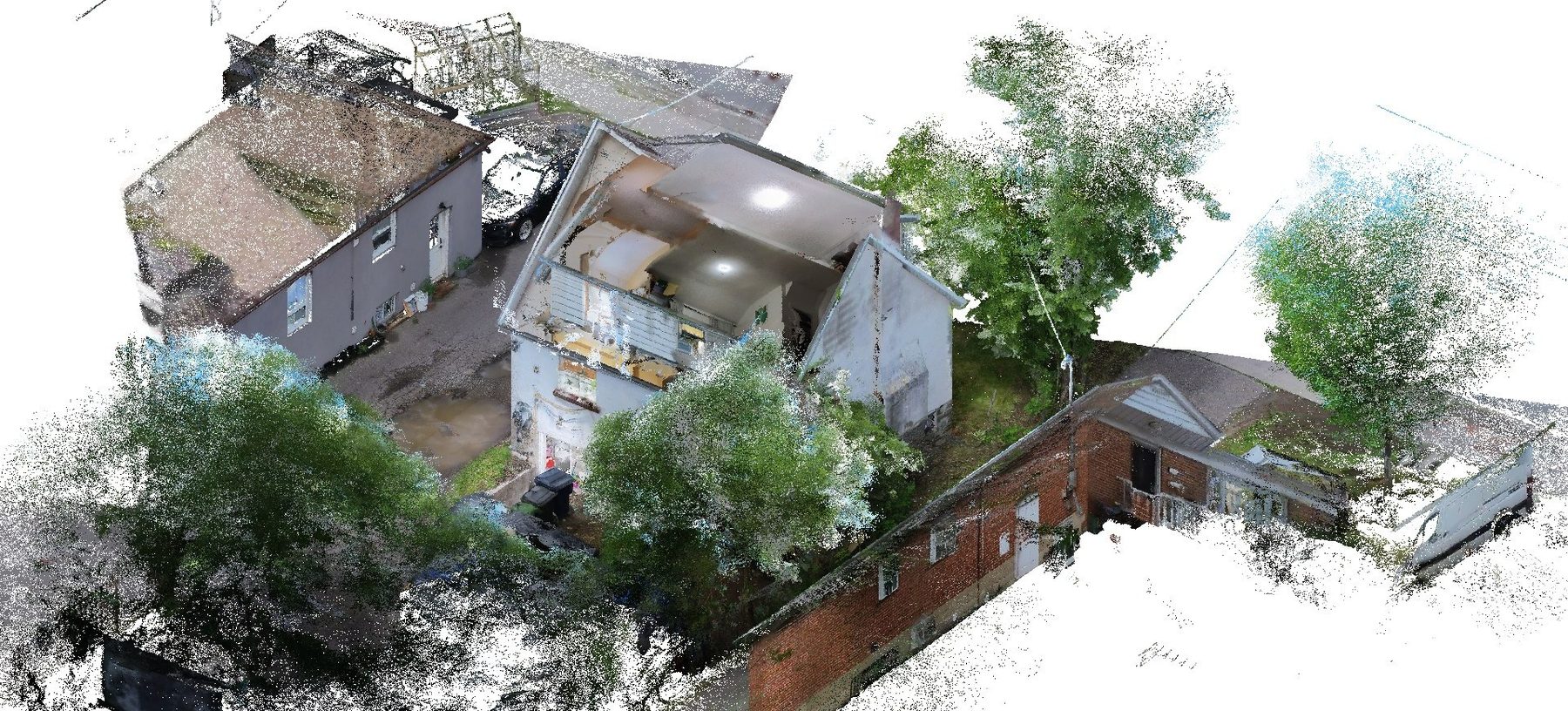
01 · Capture: walk every room with the scanner running
The OmniSLAM R8+ is a handheld SLAM scanner that builds the map as you walk, so no tripod setups are needed.
The route is what makes the data good. We start outside, circle the building, then go in and walk every room on every floor, including the basement and the stairs between levels. Then we come back out and close the loop where we started. Those repeated passes give the software overlap to lock the floors together and cancel drift.
Tenants stay home. Nobody has to move furniture, and the crew spends a few minutes in each unit.
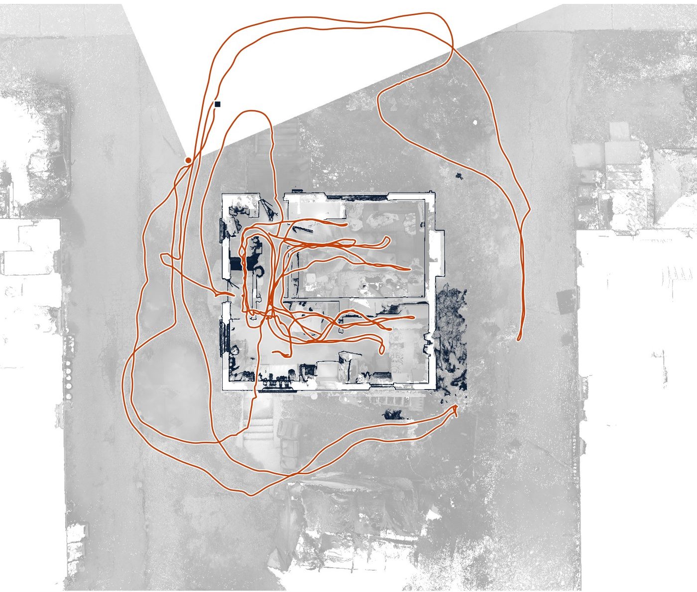
Scan time per house:
- House A · 12:56 · 2 levels · 3,079 sq ft
- House B · 8:34 · 2 levels · 2,293 sq ft
- House C · 7:41 · 3 levels · 1,885 sq ft
- House D · 8:00 · 2 levels · 2,246 sq ft
- House E · 6:18 · 2 levels · 2,207 sq ft
- Total · 43:29 · 11 levels · 11,710 sq ft
02 · Process: solve the trajectory and colour the cloud
Back at the office, OmniSLAM Mapper re-computes the whole walk using every loop closure, then paints each point with colour from the 360° panoramas. The result for House C is about 50 million coloured points covering the house, the yard and the street edge.
Mapper also writes a quality report for every scan. It splits the building into floors and shows how consistent each floor is with itself. For House C it reported average deviations of 3.3 mm across the lower and ground floors and 2.0 mm upstairs. That is a consistency check, not a survey certificate, but it tells us quickly whether a scan is clean enough to draw from or needs another pass.
03 · Section: find each floor, then pick the cut height
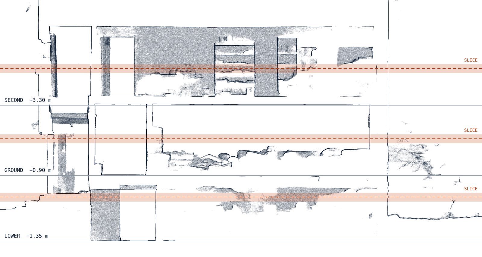
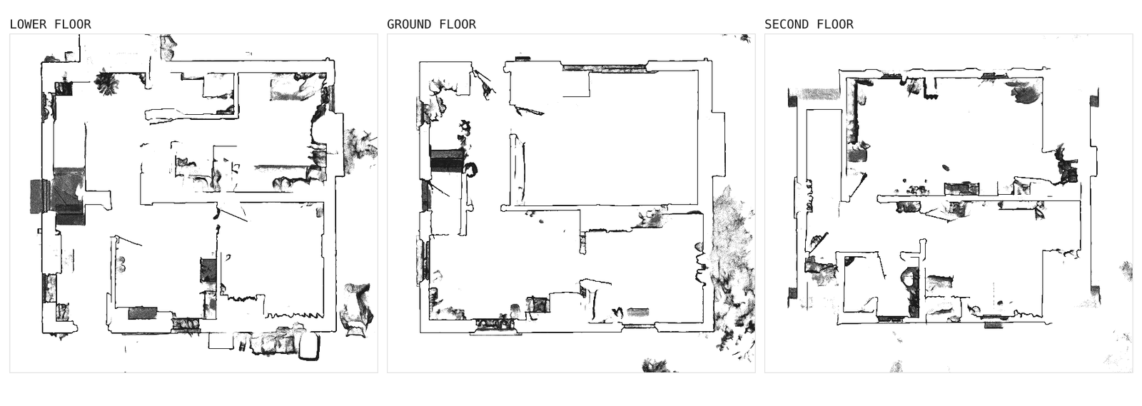
A floor plan is a horizontal cut through the building. We first take a vertical section through the cloud to read the true floor levels. In House C they sit at −1.35 m, +0.90 m and +3.30 m relative to the scan origin.
We then cut each level roughly 1.1 to 1.4 m above its floor. That height passes through walls, doors and windows and stays under most kitchen cabinets and over most furniture, so the cut reads like an architect's plan.
04 · Slice: every wall, door and window, at true scale
Each slice is a thin layer of points seen from directly above. Walls show as clean double lines, door openings as gaps, window recesses as notches in the outer wall. The stairs show up as dense bars where the cut passes through the treads. Nothing here is estimated; every line is measured.
05 · Draft: trace the slice in CAD and add what people read
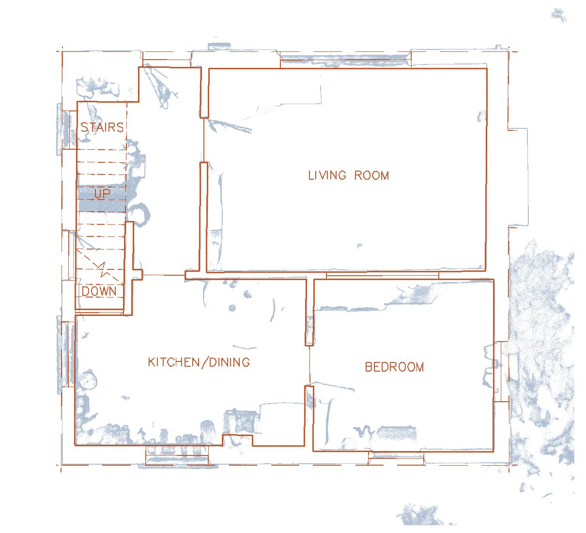
The slices go into CAD as a reference layer and the drafter traces over them: wall faces, openings, door swings, stairs with up and down arrows, closets and fixtures. Clutter left in the slice, like a sofa or a stack of boxes, is simply ignored.
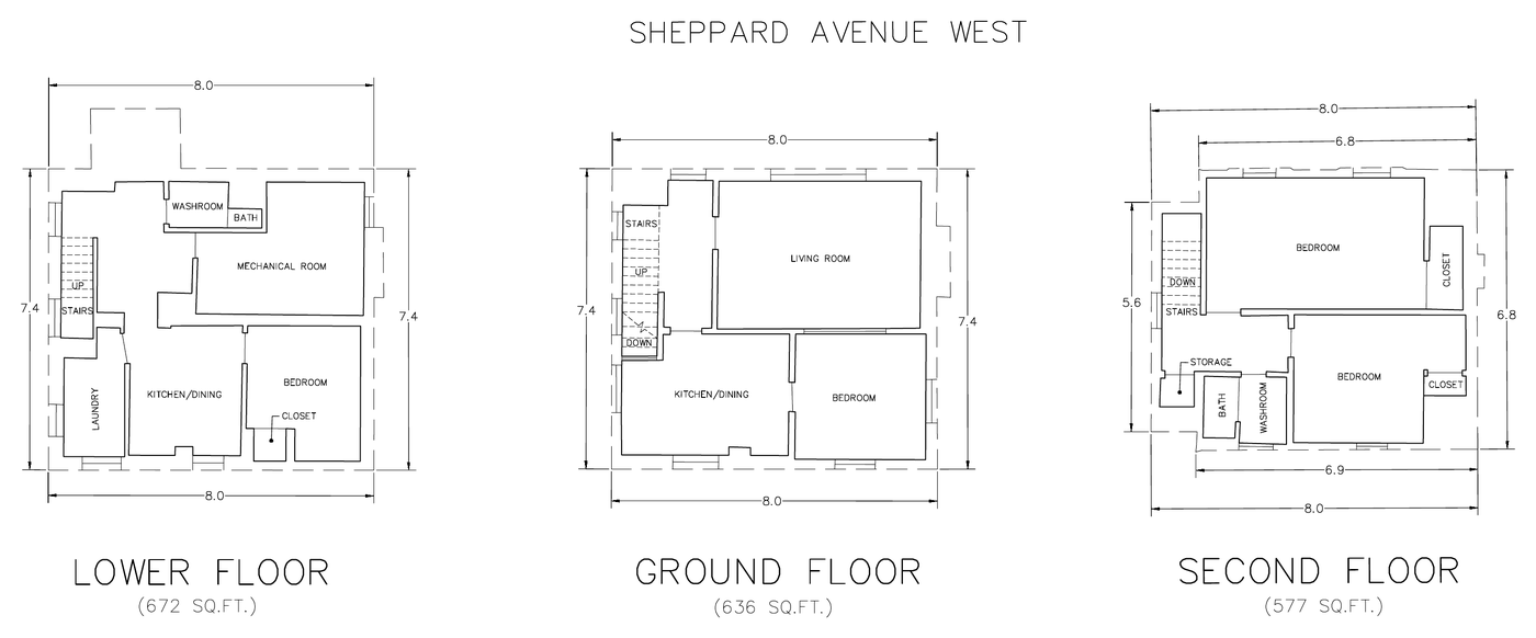
The drawing then gets what the client actually uses: room names, overall dimensions in metres, the exterior outline as a dashed line, the street for orientation, and the gross floor area of each level in square feet.
Below is the delivered ground-floor plan laid back over the scan it was drawn from.
06 · Deliver: eleven plans, one drawing file
All five houses sit in a single DWG on a shared layout, with one PDF sheet per house for people who don't open CAD. The registered point clouds go with them, so the architect can check a dimension or draw a section later without anyone going back to site.
- DWG · all 11 plans in one layered file
- PDF · one sheet per house
- LAZ · colour point cloud per house
- GFA · per floor, in sq ft, on each sheet
- Turnaround · quoted 5 business days after site access
What these plans are
They are measured as-built floor plans for design, leasing, renovation and building permit applications.